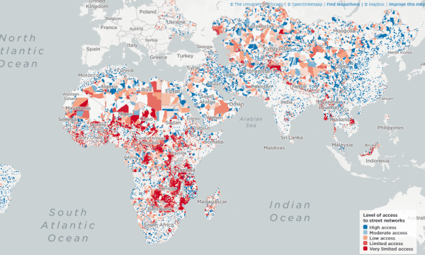
Million Neighborhoods is a free online map that helps you find areas with limited access to streets. This map gives a comprehensive look at the informal settlements or slums across Africa, Middle East, South-East Asia, and more. Most communities in those locations are so density peaked with no proper routes and addresses.
This visual tool is an initiative by scientists at the University of Chicago’s Mansueto Institute for Urban Innovation. The idea behind the map is to easily identify the informal settlements all around the world with lack of street access. Lack of street access means a lack of vital infrastructure and services. It can help to identify the areas most in need of roads, water supply, power, sanitation, etc.

Also read: Free Global Sprawl Map to Check Street Connectivity
Find Areas with Limited Access to Streets
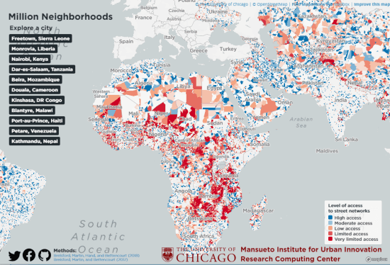
Million Neighborhoods helps you find informal settlement around the world. The map is built upon OpenStreetMap with street data plotted on top. The uses color code to show the areas with very limited access to streets to well-connected areas. It shows you a list of cities on the left which you can visit to explore the informal settlements and check how connected different areas are.

This is an interactive map where you can zoom on any particular location to have a closer look. On the bottom right side, you get an index of level of access to the street network. This index shows you the color code to read the map. It uses different colors to highlight areas that are
- High access
- Moderate access
- Low access
- Limited access
- Very Limited access

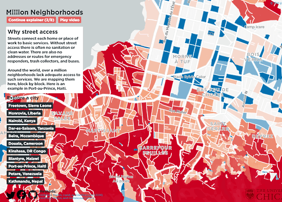
The red areas in the maps are informal settlements that are poorly connected neighborhoods. Whereas the blue areas are the formal settlements with well-developed infrastructure and connectivity.
If you are having difficultly using this map then there is an explorer to help you get started. You can start it from the top left corner. This explorer explains everything about this map in 8 steps with the help of an example.
Wrap Up
This Million Neighborhoods map gives you an insight into the informal settlements and areas with poor connectivity. This can help communities and movements to easily identify the areas with a lack of essential infrastructure such as roads. A proper connection is essential for developments as it is not possible to provide basic services like water supply, emergency services, sanitary, etc. with connectivity.