Shadow calculator is a wonderful free online tool to calculate the position of the Sun and predict the size and shape of shadows at different times of the day for any place on the Earth and for any calendar day. The application makes extensive use of Google Maps to navigate to the location and visualize the shadows.
The size and shape of a shadow on the face of the Earth is largely affected by the angle at which sunlight strikes the object. Since the position of the Sun in the sky changes throughout the day, the angle and direction from which the rays hit the object also change. As a result, the shadows cast by the objects change in terms of length and shape.
When the Sun is at the horizon it makes large angles with objects and this makes shadows long. The reverse happens when the Sun is at its highest point overhead.
Shadow Calculator uses Google Maps and a set of Astromathematical calculations to forecast and visualize the shadows for us.
Apart from this, Shadow Calculator also provides the following information for the selected location on Google Maps for any particular day:
- Duration of the day
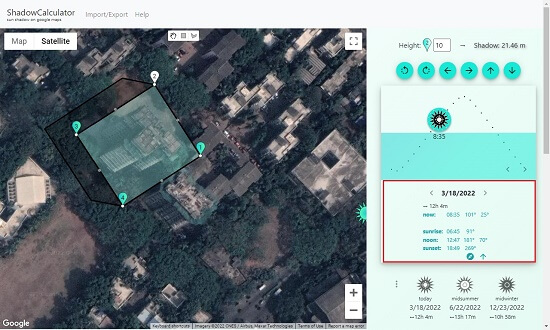
- Time of Sunrise, Noon and Sunset
- Position of the Sun: Azimuth as well as Altitude
After spending some time with Shadow Calculator for some time, I found that the prediction of shadows and the other data that it provides is pretty accurate and precise.
Here at the steps that are to be followed:
1. Go to Shadow Calculator from the link provided at the end of this article
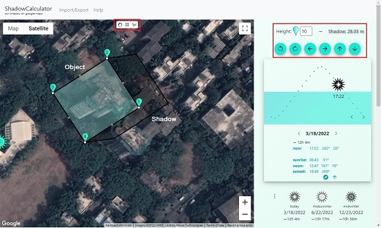
2. Navigate to the required location on Google Maps and use the rectangle or polygon tool to draw an area on the map. This will be the area for which shadow prediction will be done. Use the tools in the side panel to rotate and move you area as required for greater precision.

3. Specify the height (in meters) for each point of the area so that you can more or less represent the 3D object, like your house, some tower etc. You can click on a point and change its height in the side panel on the right.
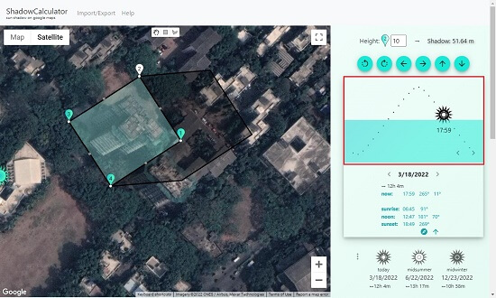
4. The bluish-green polygon represents the area you marked above while the greyish shaped polygon simulates the casted shadow directly on the map.
5. Click-Drag the Sun from the graphic in the panel to see how this shadow changes from Sunrise to Sunset.

6. Other relevant data like time of sunrise / sunset, and sun’s angle etc. for the selected date and location will be displayed in the side panel in real time.

If you are building your house, you can actually use Shadow Calculator and analyze how much Sun light your home and garden will receive and from which direction so that you plan accordingly.
A good set of keyboard shortcuts too are available. You can read more about them from the Help button. To save your location and object / shadow data as a CSV file and import it as a layer into Google Maps, use the Import / Export button.
Verdict:
Shadow Calculator is a practical and precise tool for house builders and engineers to understand sun’s paths for planning the house facades and estimating the cooling needs of the structure that they are building. It is also a fascinating tool for hobbyists and science nerds to gain more information about shadows and sun’s angles on the face of the Earth.
Go ahead and use it from this link.