MapsData is a collection of free online geocoding tools that can be used in order to convert various different geographic annotation formats used by famous applications like Google Earth or Marble. The very simple explanation of what applications offered by MapsData do would be mass conversion of geographic locations (postal codes, street addresses) into geographic coordinates (longitude and latitude), that’s what geocoding is.
Next to geocoding, there’s also something called reverse geocoding, which is also supported by MapsData. Reverse geocoding is exactly what you would expect it to be, the opposite, when you take a list of geographic coordinates, and then convert them into countries, cities, postal codes and street addresses.
MapsData is a set of 18 different individual and batch online geocoding tools where you can convert either single geographic values, meaning a single set of geographic coordinates, or you can use it in order to batch geocode entire lists of coordinates that are saved in either Excel or CSV format.
Key features of MapsData are:
- Free and simple to use: drag and drop conversion easy setup
- Supports bi-directional geocoding, to and from coordinates
- Covers the entire world with, over 240 countries supported
- Can be used to geocode postal codes, addresses, cities, etc.
- Geographic coordinates conversion and geocoding supported
- Single entry converter: convert one geocoding value at once
- Batch conversion: supports batch geocoding (Excel/CSV import)
- KML converter: convert Excel/CSV to KML (used by Google Earth)
- Web based: perform all the conversions easily inside web browser
Free accounts of MapsData are limited to only 1000 rows of conversion, when doing batch geocode conversion and the level of detail that you get when displaying the converted values on a map is not as precise (map is presented in grayscale). Note also that in future the functionality of the free accounts might not be the same because MapsData team is still refining their pricing.
Another important thing that you should know before we begin demonstrating these free online geocoding tools is that even though we said in the feature list above that practically the entire world is supported, most tools only work for the United States and United Kingdom. There’s only a few, like the country to geocode tool, that can be used globally.
How to convert postal codes, street address and more with MapsData Single Entry Tool
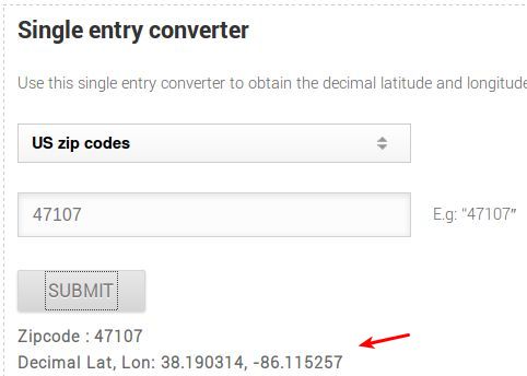
Let’s start with the simplest tool first. What you see on the image above is the Single Entry geocode converter in action. We converted a US based ZIP code into decimal longitude and latitude. All that we had to do in order for this to work is select the country (UK or US only) and then down below type in the postal code that you would like to convert to geographic coordinates.
Batch Geocoder and Converter
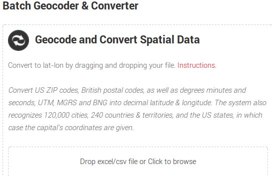
Now we’re moving to the main batch converter. We’re saying main, because this is where you can open up a CSV or Excel file that contains either ZIP codes, postal codes, city names, country names and convert them all, regardless of what they are into decimal geographic coordinates.
Create a Excel spreadsheet and name one column after whatever it is that you would like to convert. It can for example be ZIP, if you are gonna type in postal codes in the column. Once you’re finished adding postal codes to the spreadsheet save it and upload to the Batch Geocoder.
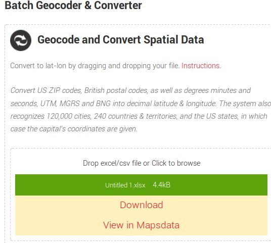
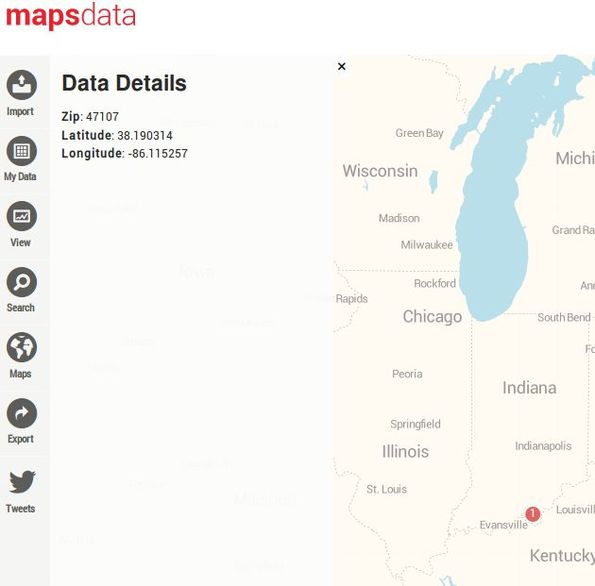
Results should come up practically right away, although it might last a bit longer if you’ve added a lot of entries to the spreadsheet. You’ll know that these free online geocoding tools are done when the “View in Mapsdata” option comes up. This will allow you to analyze the entered locations on the map right away. Each red dot on the map will be one entry from the spreadsheet. Click on the red dot and you can see geographic coordinates of it in the left sidebar.
Are you confused about what we just did? Here’s a short break down of what was done so that it’s more easier to keep up:
- 1. Created Excel spreadsheet, named the first column “ZIP”
- 2. Added all the ZIP postal code values for conversion to column
- 3. Uploaded the spreadsheet to the Batch Geocode tool
- 4. Waited for the conversion to complete and clicked on view map
- 5. On the map, each entry from the ZIP column had its own dot
- 6. Click on the dot reveals the ZIP code and geo coordinates
It might be a bit confusing at first, but these online geocoding tools are actually very easy and very fast. Let’s have a look at the KML converter.
How to convert Excel, CSV and more to KML using KML Converter
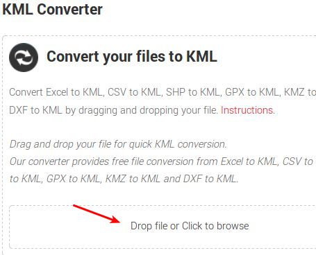
The second flagship converter of MapsData is the KML Converter. This utility allows you to convert various different geographic annotation formats to KML, which is a more common format used by Google Earth and Marble, for example. Supported formats that can be converted are:
- CSV
- EXCEL (XLSX)
- SHP
- GPX
- KMZ
- DXF
Everything works the same like with the previous converter. Drop a file on or click on the Click to browse button to open up the file selection tool.
Once that a file is selected conversion starts right away. Once it finishes, you will be left with a converted KML file. You can select any of the formats from the list of supported formats above.
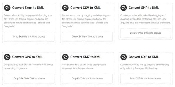
Individual KML converters for single format conversion
These are the same as the KML Converter that we showed you in the previous section, except here each of the formats has it’s own separate converter.
Everything else is the same, simply select a file and it will be converted right away leaving you with a converted KML file that you can download.
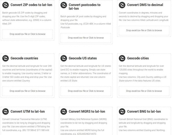
Individual geographic information converter
We’re gonna end this, the same way that we started it, with geocoding tools from the Geocoder Converter, only just like the individual converters of the KML Converter, they are here also broken down into each it’s own individual converter. Because of that we have:
- ZIP code to latitude and longitude converter
- Geographic coordinates in degrees to decimal conversion
- Geocode countries: used specifically for country geocoding
- United States Geocode: for United States geocoding
- Postcode to latitude and longitude converter for UK postcodes
- Cities geocode: around 140 major world cities can be geocoded
- UTML or Universal Transverse Mercator to Geocode converter
- Military Grid Reference System, MGRS to latitude and longitude
- BGN, British National Grid to latitude and longitude converter
Keep in mind that all of these are also available in the second tool that we mentioned from the top the “Batch Geocoder and Converter” only here every single of the supported tools has it’s own converter. Conversion works the same like with all the other tools of this free online geocoding tool set.
Conclusion
MapsData offers a very interesting selection of tools. Every person that’s interested in geocoding and needs geocoding tools should check out this free website. Both bath and individual conversion of not just geographic coordinates is supported, but also various different geographic notation formats. Try MapsData and let us know what you think in the comments section down below.
