Daylight Chart is a free and open source software to View Sunrise and Sunset Time for any Location of the World. It lets you view daylight and night time on a graphical chart for every month of the year. The graphical chart is very easy to interpret. The software includes a long list of important cities from all around the World. You can view sunrise and sunset time for all of them and even add a location manually. The software reads locations based on longitudes and latitudes, hence making it easy for you to enter any location. You can even open chart for multiple locations in different tabs. A chart can be saved as a PNG image or can be directly printed.

Click here to See All World Time Zones With Live Time.
How To View Sunrise and Sunset Time Using Daylight Chart?
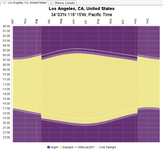
The illustrative chart provided by this software is pretty easy to read. On the X-axis of chart, 12 months of year are plotted, and on Y-axis, time is plotted in 24 hours format. The illustrative chart displays night time, day time, day light saving time, and civil twilight. With the help of grid lines, it becomes pretty easy to track sunrise and sunset time for each month of year.

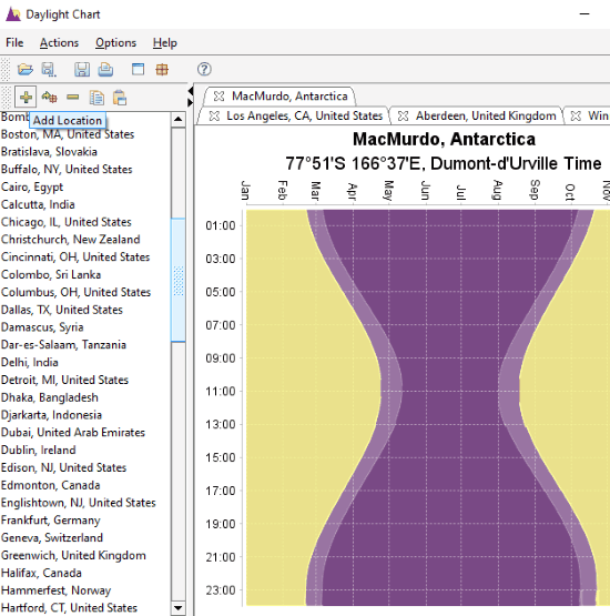
To view sunrise, sunset, daytime, or nighttime for a location, you can select the city from panel available on the left side of the interface. If a city is not mentioned, you can look for the closest city in the list. If you are looking for precise data, you can add a location manually.
How To Add A Location Manually To View Sunrise and Sunset Time?

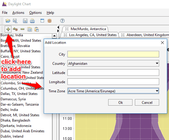
To add a location manually, click on the + button available over the location list. This will open a pop-up window as shown above. Here, you can enter the city name, select a country, enter latitude and longitude, followed by selecting Time Zone. Once done, click Ok. The location will appear in the list. Select the location from the list to view its daytime chart.
If you want, you can also edit a location to change its attributes.
Other Options Available In Daylight Chart
There are several options available in this software. I will not mention all, but the important ones.
Let’s take a look:
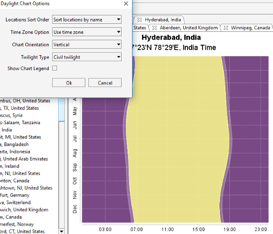
Change Chart Orientation: By default, the chart orientation is set as Standard, that is horizontal. Under Options menu, you can change the orientation to Conventional or Vertical.

The orientation is set as Vertical for the daytime chart in the above screenshot.
Sort Location: You can sort location available in the location section according to name, or according to latitude.
Time Zone: The time zone for the time displayed on the chart can be set to Local time or US time zone.
Save Chart or Print Chart: If you want to save a chart as Image or print it, you can do that pretty easily. You can save a chart in PNG format image, right on your PC.
Verdict:
Daylight Chart can turn out to be an amazing tool who regularly need daytime and nighttime data of various location. It works without internet, thus you do not have to go online to view sunrise or sunset time. All you need is a location name or longitude and latitude of the location.